

Y Glog [Draws Drum]
Good walks are even better shared.
Overview
Y Glog [Draws Drum]
Y Glog, often whimsically referred to as Draws Drum, is a charming Marilyn nestled in the stunning expanse of the Brecon Beacons National Park. Standing at an elevation of 540 meters, it's a delightful choice for both beginner and seasoned hikers.
Geology
The geological composition of Y Glog offers insights into its ancient past. With its sandstone formations mixed with limestone, hikers will find fascinating outcrops and layers revealing the history of geological shifts that shaped this land. It’s like nature’s own history book, opened to the pages of the Triassic and Jurassic periods.
Routes
Glog Farm Walk
This picturesque route begins at Glog Farm, winding through the verdant valleys before you feel the exhilaration of the ascent. At 5.5 km long and taking about 2.5 hours, it's manageable for most and rewards you with splendid scenery.
From Cwm Glo
For those seeking a bit more adventure, the route from Cwm Glo stretches over 7.2 km and is a real thigh burner, taking approximately 3 hours. This route navigates a wild moorland, so be prepared for a proper sweat!
Summit Features
Upon reaching the summit, you'll be greeted by a substantial cairn—a great place to snap a selfie (that is, if you can manage the 'victory pose' after the climb). The sense of accomplishment is palpable!
Terrain
Expect grassy slopes broken up by rocky outcrops, along with some delightful heather patches. Just a heads up: A few boggy spots may appear unannounced, so proper footwear is essential. Don’t let your socks become sponges!
Views
The views from Y Glog are breathtaking. Looking out, you can spot the Black Mountains, rolling valleys, and a vast expanse stretching toward the Bristol Channel. Spring and early autumn provide the clearest vistas, ideal for those perfect Instagram shots!
Hazards
As with many mountain hikes, be warned of sudden weather changes. Conditions can fluctuate, so take heed and come prepared. Those boggy bits may also present a challenge, so watch where you’re stepping!
Access
Parking is available at Glog Farm, and public transport options from Brecon may require a bit of legwork to reach the trails. Plan accordingly, as the closest town, Brecon, offers a range of amenities.
Facilities
Although the mountain lacks facilities, Brecon provides a delightful selection of cafes and shops, perfect for a post-hike treat!
History
In local lingo, 'Y Glog' translates to 'The Ring', perhaps a nod to historical sites in the region. The rich tapestry of culture and history here adds to the experience of visiting this remarkable peak.
So whether you're after a brisk walk or a hearty challenge, Y Glog offers nature’s embrace and stunning views that are sure to lift your spirits. Pack your bags, lace up your boots, and head out into the wonder that is Wales!
Happy hiking!
Explore routes near Y Glog [Draws Drum]
Public walks starting within 80 km of this hill. Nearby does not mean a route reaches the summit; check its map and access before setting out.
Hafren Forest: full Source of the Severn Trail
View route
Ystwyth Trail: Black Covert to Llanilar and back
View route
Elan Valley: Reservoir Trail to Pen y Garreg Dam
View route
Waun-oer, Maesglase and Cribin Fawr guided mountain walk
View route
Route planning notes
These notes describe possible approaches, not verified navigable routes or permission to cross land. Check current paths, local access rules and conditions before setting out.
Glog Farm Walk
A scenic route starting from Glog Farm that meanders through lush valleys and up to the summit of Y Glog.
From Cwm Glo
A more challenging ascent from Cwm Glo, this route takes you through wild moorland before tackling the final slopes to the summit.
Make a day of it, together
Find someone to share the walk with, or organise a day out along a route you like.
Photo Gallery
View all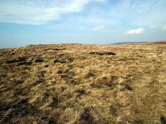 Photo could not load
SN7981 : The Draws Drum Plateau
John Lucas
Hill facts and local notes
Classifications
Elevation
574m
1,883 ft
Prominence
106m
Coordinates
52.4148, -3.7796
SN790811
OS Map
135
Explorer: 213
At the Summit
The summit is distinguished by a prominent cairn, providing a perfect spot for weary hikers to catch their breath and enjoy the views.
Terrain & Geology
The area is predominantly composed of sandstone, with occasional limestone outcrops that provide fascinating contrasts in the landscape. The sedimentary rocks tell a story of ancient seas that once covered the region.
Views & Scenery
From the summit, hikers can enjoy panoramic views including the Black Mountains, the picturesque valleys, and on a clear day, even out to the Bristol Channel.
History & Heritage
Name Origin
Y Glog translates to 'The Ring', which may have historical connections to ancient enclosures or fortified sites.
Historical Significance
This area has rich cultural heritage, with evidence of past settlements and traditional farming practices.
Getting There & Facilities
Check current local access restrictions, parking rules and transport timetables before travelling. These notes do not confirm public access to the summit.
Parking
The nearest parking is available at Glog Farm, where there is space for a limited number of cars. Be considerate—don't block gates!
Public Transport
Bus services run from nearby towns such as Brecon, but may require a bit of a walk to reach the trailhead.
Nearby Facilities
While there are no facilities on the mountain itself, Brecon offers a selection of cafes, shops, and public toilets.
Safety Information
Known Hazards
- Beware of sudden weather changes, as conditions can shift rapidly. It can also be quite boggy in places, so sturdy footwear is advisable.
General Safety Tips
- Check weather conditions before setting out
- Carry appropriate clothing and equipment
- Let someone know your planned route
- Take a map, compass, and GPS device
- Carry emergency supplies: food, water, first aid kit, torch
Hills
Some common questions about the hills answered
Are there group walks up Y Glog [Draws Drum]?
Many walkers use Walkmates to join or organise walks with others. You can check for group walks around Y Glog [Draws Drum] through the maps
Are there other walkers around Y Glog [Draws Drum]?
Activity varies by location and time, but Walkmates lets you see whether others have shared walks or shown interest in this area. Find other people through the walking friends search walking friends for Y Glog [Draws Drum] search or of course create your own walk for Y Glog [Draws Drum]
Can I organise a walk to Y Glog [Draws Drum]?
Yes. If there aren’t any walks listed already, you can create a walk and make it available for others to join.
If you're signed up to Walkmates, you can create a walk to Y Glog [Draws Drum].
How do I find a walk up this hill?
There are often multiple ways to walk this hill, depending on experience and route preference. Walkmates helps you explore walks and routes that others have shared.
Can I suggest a new route up Y Glog [Draws Drum]?
Yes. You can suggest or create routes to share with others. Walkmates focuses on the social side of walking, so routes are used to help people organise walks and explore areas together, rather than as detailed navigation tools or route libraries.
Other uses really appreciate knowledgeable walkers sharing their routes. Share your favourite route to Y Glog [Draws Drum] here
The is an error or something incorrect about this hill. How do I let you know?
We always strive to keep the information on Walkmates as accurate as possible. If you find an error, please let us know through the contact form and we'll aim to correct it as quickly as possible
Community Discussion
Comments
Location
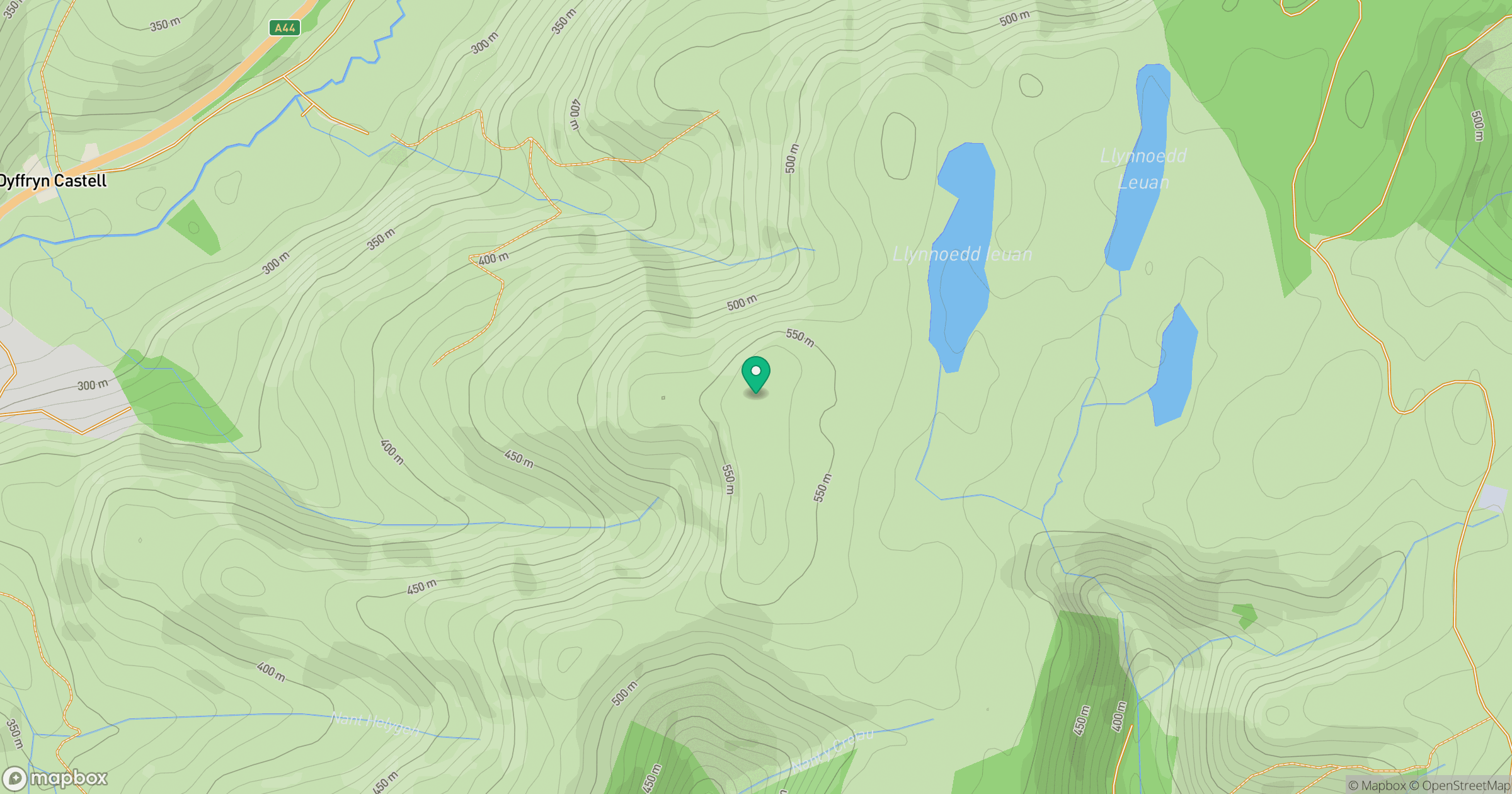
Grid reference: SN790811
View on OpenStreetMapOpens a map in a new tab, centred on the hill.
Hills within 30 km
Straight-line distance, not a walking route or confirmation of access.
No comments yet. Be the first.